


Specialists In Swimming Pools & Landscape Designs On Slopes & Large Acreage Blocks

Landscape Design +
Project Management

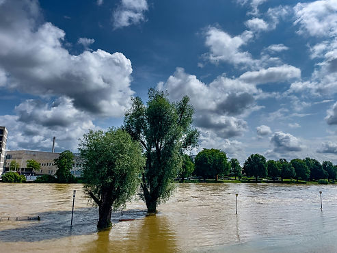
Flood‑Affected Landscape Documentation NSW
Clear, coordinated landscape documentation for flood‑affected residential Development Applications across NSW
Flood‑affected land introduces an additional layer of judgement during the Development Application (DA) process, particularly in how the ground plane is planned, used and interpreted across the consultant team.
On residential projects within flood‑prone areas, the issue is rarely the presence of flooding itself. More often, it is whether the external environment is legible when read alongside architecture, civil and planning inputs.
Driveways, access, open space, planting and site interfaces sit at the overlap between disciplines. It is at this overlap that misinterpretation most often occurs.
This work sits within our broader Landscape Documentation for Residential Developments NSW service, where documentation is prepared to ensure external works are clearly understood, proportionate and aligned across the consultant set.
Flood‑affected sites and DA landscape coordination
Flood‑affected landscape documentation sits at the point where multiple consultant inputs converge.
Landscape plans are often relied upon to explain how the ground plane functions in response to site constraints and how external areas operate within the proposed development.
Across flood‑affected residential sites, landscape documentation is frequently used to help clarify how access, open space, planting and site works come together in a way that can be consistently interpreted by assessment teams.
The emphasis is not on technical flood resolution. It is on ensuring that the external environment is understandable when viewed alongside engineering, planning and architectural inputs.

Where flood‑affected projects encounter issues
On most flood‑affected sites, the focus quickly shifts to how outdoor areas are organised and how site works are read at ground level.
This typically includes built form alongside driveways, hardstand areas, shared access, retaining, pools and outdoor spaces.
Where flood mapping or site constraints apply, the way these elements sit together becomes central to how the proposal is assessed.
From experience, pressure points most commonly arise around:
-
how access and circulation are resolved through the site
-
how open space is structured in relation to built form
-
transitions between hard and soft landscape areas
-
boundaries and site interfaces
-
the clarity of levels, thresholds and movement
Clear, coordinated landscape documentation helps align this response across disciplines, allowing the external environment to be read as intentional rather than incidental.
Why landscape clarity matters on flood‑affected land
On constrained sites, landscape plans are often the clearest representation of how a project works at ground level.
They show how people enter, move through and use the site, and how built form relates to external areas.
Across flood‑affected residential projects, a consistent challenge is ensuring the landscape layer communicates enough intent to be clearly understood by those assessing the DA.
When landscape documentation is coordinated and legible, the broader submission becomes easier to interpret. This reduces back‑and‑forth during assessment and helps maintain alignment across the consultant team.

How landscape documentation functions on flood‑affected sites
Landscape documentation on flood‑affected sites plays a specific coordination role within the DA set.
It links multiple consultant inputs at ground level and clarifies how the external environment responds to site constraints.
This includes demonstrating how access, circulation, open space and planting sit within the broader site strategy.
The value lies in consistent interpretation across the submission rather than in resolving technical flood conditions, which sit with engineering and specialist inputs.
What coordination looks like in practice
Flood‑affected projects differ from unconstrained sites less in what is shown, and more in how the ground plane is interpreted during assessment.
On these sites, landscape documentation is read more closely alongside civil, architectural and planning inputs.
Assessment sensitivity increases, particularly around access, boundaries, movement and the structure of open space.
Coordination focuses on:
-
proportional landscape responses relative to the overall proposal
-
clear definition of site works without unnecessary detail
-
consistent alignment between landscape, architecture and civil inputs
The objective is not to over‑resolve the site, but to ensure the proposal can be read clearly without conflicting interpretation.

Working with consultant teams
We are typically engaged alongside architects, planners, civil engineers and project teams once flood constraints are identified as a factor in how the site will be assessed.
Our contribution is grounded in judgement and proportionality rather than volume documentation.
Landscape documentation is prepared to be internally consistent, aligned with architectural and civil information, and clear in scope and intent.
On flood‑affected sites, this includes ensuring that the landscape layer supports the overall proposal without duplicating or competing with engineering inputs.
Typical projects where this applies
Flood‑affected landscape documentation is most commonly engaged where residential developments include meaningful site works within or adjacent to constrained areas.
This includes:
-
residential developments with shared or structured access
-
sites with defined open space areas or external amenity
-
projects with transitions between built and open areas
-
developments where ground‑level organisation is critical to assessment
In each case, the emphasis is on clarity and alignment, ensuring the ground plane can be understood across the consultant set.
Reducing review cycles and post‑approval friction
Flood‑affected sites often attract clarification requests that relate to interpretation rather than compliance.
Questions commonly arise around access, levels, site interfaces and how the external environment responds to constraints.
Early coordination helps reduce these issues.
After approval, external works are often revisited to respond to consent conditions, refine coordination or support certification.
Where we remain involved, our role is to maintain continuity between approved documentation and subsequent stages.
The focus remains on alignment rather than expansion — ensuring updated civil or engineering inputs do not unintentionally alter the approved external environment.
Projects with clear DA‑stage coordination generally move more smoothly through certification with fewer clarification cycles.
Relationship to other residential development documentation
Flood‑affected landscape documentation does not change the underlying project type. It affects how development is interpreted during assessment.
For smaller developments, this may sit within Dual Occupancy Landscape Documentation NSW. For medium‑density development, it may align with Townhouse & Multi‑Dwelling Landscape Documentation NSW. For larger or multi‑level development, it may intersect with Class 2 DA Landscape Documentation NSW.
Where multiple constraints apply, this work also connects with Bushfire‑Prone Landscape Documentation NSW or Heritage Landscape Documentation NSW.
Where flood‑affected sites sit within master planned communities, this may also intersect with Master Planned Estate Landscape Documentation NSW, where estate guidelines introduce an additional layer of coordination alongside flood constraints.
In each case, the presence of flood constraints introduces an additional coordination layer rather than expanding scope.
Related residential development documentation
This service commonly sits alongside:
Service area — New South Wales
We support flood‑affected residential developments across New South Wales, working with consultant teams where external works documentation needs to be clearly coordinated within the Development Application set.
This work is most commonly engaged across flood‑mapped coastal and riverine regions, including:
Newcastle
Lake Macquarie
Hunter Region
Central Coast
Greater Sydney
It also applies to other flood‑affected areas across NSW where similar constraints influence how the ground plane is documented and assessed.
Project location does not change the approach. The focus remains on producing landscape documentation that reads clearly for assessment, supports consultant coordination and avoids unnecessary overlap with technical inputs.
Discussing suitability for a project
If you are working on a flood‑affected residential development and need landscape documentation that aligns with architectural, civil and planning inputs, we can review the site context and confirm whether this approach suits the project.
Discuss a flood‑affected project
View Landscape Documentation for Residential Developments NSW
Frequently asked questions
What is considered flood‑affected land in NSW?
Flood‑affected land is typically identified through planning controls, mapping overlays or site‑specific constraints referenced within project documentation.
Are landscape plans required for flood‑affected sites in NSW?
Often, yes. Where external works form part of the DA, landscape plans are commonly used to clarify how the site responds to flood constraints.
Do flood‑affected sites require different landscape documentation?
In many cases, yes. The difference is not design complexity, but the need for clarity, coordination and consistent interpretation.
Do you provide flood or engineering advice?
No. We do not provide technical flood or engineering advice. Our role is to ensure landscape documentation aligns with those inputs without overlap.
When should landscape documentation be prepared?
Ideally before the DA package is finalised, while site access, levels and interfaces are still being coordinated.