
Specialists In Swimming Pools & Landscape Designs On Slopes & Large Acreage Blocks

Landscape Design +
Project Management


Dual Occupancy Landscape Documentation NSW
Coordinated landscape documentation that supports clear and consistent DA assessment across the full consultant set
Dual occupancy landscape documentation forms part of the Development Application (DA) process, where site works need to be clearly coordinated and readily interpreted alongside architectural, civil and planning inputs.
This sits within our broader Landscape Documentation for Residential Developments NSW service, where we support residential development projects that require clear consultant alignment, legible site relationships and consistent presentation across the documentation set.
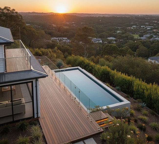
Dual occupancy developments sit in a space where scale is modest but assessment scrutiny is not. While smaller than multi-dwelling projects, they still depend on well-resolved site works to demonstrate access, setbacks, private open space and shared interfaces in a way that can be understood without ambiguity during assessment.

Why landscape documentation matters for dual occupancy developments
Dual occupancy projects are often assumed to be straightforward due to their scale, but in practice, they rely on clear coordination across architecture, civil and landscape inputs.
Where site works are not clearly aligned, issues typically emerge during assessment — particularly around access, private open space, boundaries and shared interfaces.
These projects depend less on design complexity and more on how clearly the external environment is communicated across the documentation set.
Development pathways and documentation requirements
While some dual occupancy and townhouse developments proceed under CDC pathways, landscape information is still required to demonstrate compliance with planning controls, particularly in relation to private open space, access, site coverage and external works.
In this context, documentation is less about supporting a negotiated assessment and more about clearly demonstrating compliance within a defined framework.

What we mean by dual occupancy
In this context, dual occupancy refers to residential developments comprising two self‑contained dwellings on a single lot, commonly described as dual occupancy or duplex developments.
From experience, we are also regularly engaged on closely related small‑scale residential formats, including dual‑key or dual‑lock arrangements, where landscape documentation requirements are effectively equivalent in terms of access, shared interfaces, setbacks and private open space coordination.
While terminology and planning definitions vary between councils, these projects consistently depend on coordinated landscape documentation to ensure site relationships are legible and interpreted consistently across the consultant set, which is the focus of this work.
Where projects involve increased density or multiple dwellings, the documentation approach may sit closer to Townhouse Landscape Documentation NSW or Class 2 Apartments Landscape Documentation NSW.

Dual occupancy as a coordination challenge
Dual occupancy projects tend to sit at the intersection of multiple consultant inputs. Shared driveways, adjoining dwellings, services and private areas all need to be understood together, often on constrained sites.
From experience, pressure points typically arise when:
-
access arrangements are difficult to interpret
-
private and shared spaces are not clearly delineated
-
site works are shown but not clearly prioritised
-
architectural, civil and landscape information is misaligned
We approach dual occupancy landscape documentation as a development coordination problem, not a scaled‑down residential design exercise. The focus is on making site works legible in the context of the full DA set.

How we approach dual occupancy landscape documentation
Landscape documentation for dual occupancy developments is prepared to support development application assessment and construction delivery, with an emphasis on legibility and alignment rather than visual narrative.
The focus is on how drawings are interpreted and coordinated across the consultant set, rather than how they are presented in isolation.

Site structure and interfaces
We focus on how boundaries, setbacks, private areas and shared zones are read together, ensuring interfaces between dwellings and adjoining properties are unambiguous.
Access, circulation and services
Driveways, pedestrian movement and service zones are coordinated so access arrangements can be readily assessed and carried through to delivery.


Private open space and amenity
Private open space is resolved in direct relationship to building footprints, levels and overshadowing, reducing interpretation issues during assessment.
Planting documentation and specification
Planting documentation is prepared to support assessment and construction documentation, with schedules and specifications aligned to the approved scope and site constraints.


Consultant alignment
Landscape documentation is developed alongside architectural, civil and planning inputs, reducing clarification cycles and post‑approval friction.
Landscape documentation within the dual occupancy development application
For dual occupancy developments, landscape documentation forms part of the development application package and is assessed alongside architectural, planning and civil documentation.
Councils rely on landscape documentation to assess matters such as access arrangements, setbacks, private open space provision, site coverage and the resolution of shared interfaces between dwellings.
This becomes more pronounced on sites affected by additional constraints, where documentation needs to remain aligned across multiple consultant inputs during assessment.
This commonly includes heritage-affected developments, bushfire-prone land, flood-affected sites or areas influenced by mine subsidence, where site behaviour and planning controls increase scrutiny of how external works are represented.
This may also apply to dual occupancy developments within master planned estates, where estate guidelines and covenants influence how landscape works are documented and assessed, as outlined in Master Planned Estate Landscape Documentation NSW.
Well‑coordinated landscape documentation helps ensure these matters are interpreted consistently across the assessment process and reduces RFIs, clarification requests and post‑approval rework.
Who this work is typically for
This work is usually undertaken in collaboration with:
-
architects coordinating small‑scale residential developments
-
planning consultants managing development applications
-
boutique developers progressing infill projects
-
project managers overseeing consultant alignment
Engagement is driven by judgement, prioritisation and coordination, rather than the production of standalone drawings.
Why this approach matters
On dual occupancy projects, unresolved or poorly explained site works often create friction later — during assessment, through conditions, or when moving into delivery.
A measured, coordinated landscape scope helps:
-
reduce assessment ambiguity
-
align consultant inputs early
-
avoid unnecessary re‑work
-
keep site works proportionate to project scale

Service area — New South Wales
This work is delivered across New South Wales, particularly in established residential areas where dual occupancy development is influenced by layered planning controls.
Engagement is guided by regulatory conditions, project complexity and consultant coordination requirements rather than postcode alone.
Typical contexts include:
-
low‑density residential infill areas
-
locations near centres, services and public transport
-
heritage‑affected residential streetscapes
-
sites constrained by bushfire, flood or estate controls
Discussing suitability for a project
Where a dual occupancy project requires landscape documentation that aligns cleanly with architectural and planning inputs, we can review the site context and confirm whether this approach suits the project and approval pathway.
Discuss a dual occupancy project
View Landscape Documentation for Residential Developments NSW
FAQs — Dual Occupancy Landscape Documentation
Is this the same as a council landscape plan?
Landscape documentation for dual occupancy developments forms part of the DA submission, but is prepared with a focus on coordination and legibility across the full consultant set, rather than as a standalone compliance drawing.
Do you provide planting schedules and specifications?
Yes. Planting documentation is prepared where required for assessment and construction, aligned with the approved landscape scope and site constraints.
Are you providing planning or compliance advice?
No. Planning advice and statutory interpretation remain with the planning consultant. Our role is to make the site works clear, proportionate and easy to assess.
When is landscape input most valuable on a dual occupancy project?
Early alignment is often most effective — particularly on constrained sites or where access, private open space or heritage considerations are likely to attract assessment attention.