
Specialists In Swimming Pools & Landscape Designs On Slopes & Large Acreage Blocks

Landscape Design +
Project Management

Flood‑Affected Landscape Plans for DA (NSW)
Making Flood‑Affected Sites Read Clearly at Ground Level
Flood‑affected land introduces an extra layer of judgement during the DA process, particularly around how the ground plane is planned, used and interpreted across the consultant team.
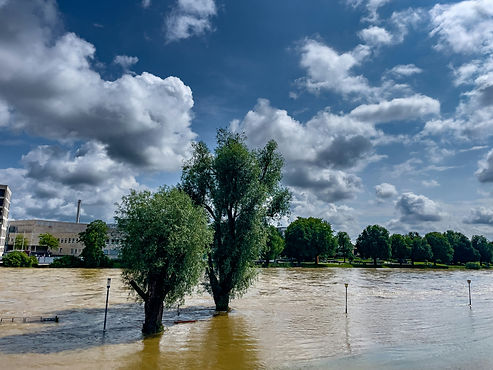
On residential projects in flood‑prone land and flood zones, the issue is rarely the presence of flooding itself. More often, it is whether the external environment is legible when read alongside architecture, civil and planning inputs. Driveways, access, open space, planting and site interfaces tend to sit at the overlap between disciplines, and that overlap is where misinterpretation can occur.
From experience, flood‑affected landscape plans for DA in NSW are most effective when they align intent early, reduce redesign, and avoid misinterpretation during DA assessment. This is commonly required across flood‑affected sites in Newcastle, the Hunter Region and coastal NSW, where site layout and ground‑level decisions attract closer scrutiny.
If you’re working through a flood‑affected site, an early review can help clarify what actually needs to be shown, and what does not. You’re welcome to upload site plans for an initial review and fee estimate.
Flood‑Affected Landscape Plans for DA in NSW
Flood‑affected landscape plans for DA in NSW sit at the point where multiple consultant inputs converge. They help clarify how the ground plane works in response to site constraints and how external areas are intended to function within the proposal.
Across residential developments in Newcastle, the Hunter Region and broader NSW, these plans are often relied upon to explain how access, open space, planting and site works come together in a way that can be consistently interpreted by assessment teams.

Flood‑Affected Sites: How Projects Tend to Unfold
On most flood‑affected sites, the focus quickly moves to how outdoor areas are organised and how site works are read at ground level. This typically includes residential buildings alongside driveways, hardstand areas, shared access, retaining conditions, swimming pools and outdoor entertaining spaces.
Where floodways or mapped flood‑affected zones apply, the way these elements sit together becomes central to how the proposal is assessed. Setbacks, transitions between hard and soft areas, and the structure of open space often need to be communicated with greater clarity than on unconstrained sites.
Clear landscape plans and drawings help align this response across disciplines, allowing the external environment to be read as intentional rather than incidental within the DA submission.
Why Landscape Clarity Matters on Flood‑Affected Land
On constrained sites, landscape plans are often the clearest representation of how a project works at ground level. They show how people enter, move through and use the site, and how built form relates to open space and planting.
Across flood‑affected residential projects, a consistent challenge is ensuring that the landscape layer communicates enough intent to be easily understood by those assessing the DA. When landscape plans and drawings are clear and coordinated, the broader submission is easier to interpret. This often helps reduce back‑and‑forth during assessment and keeps the consultant team aligned as the submission progresses.

How We Approach Flood‑Affected Landscape Plans
Site Interfaces & External Environment
We approach flood‑affected landscape plans by focusing on the parts of the site where interpretation matters most. This includes entries, boundaries, access routes, transitions between built and open areas, and the relationship between private and shared outdoor space.
Rather than listing landscape elements, we structure drawings to show how the external environment works as a connected system. This helps the ground plane read clearly when viewed alongside architectural and civil information.
Coordination Across Consultants
Flood‑affected sites rarely benefit from isolated documentation. Our role sits between disciplines, aligning landscape plans and drawings with architectural intent, civil site works and planning inputs so the external environment is interpreted consistently.
In practice, this means applying judgement about what needs to be resolved visually for the DA to make sense. We prioritise alignment and clarity over volume, shaping the landscape documentation around how the project will actually be reviewed.
Where projects are already underway, a targeted mid‑process review can help confirm whether coordination is holding or whether key interfaces need clearer resolution.


Readability Within a DA Submission
We approach landscape drawings with the assumption they will be read by people outside the design team. Legibility, hierarchy and consistency are treated as core requirements.
On flood‑affected sites, this clarity becomes particularly valuable around access, shared open space and boundaries, where small ambiguities can lead to larger interpretation issues during assessment.
The Role of Landscape Plans on Flood‑Constrained Sites
On flood‑affected land, landscape plans play a specific role within the DA set. They help connect multiple consultant inputs at ground level and clarify how the external environment responds to site constraints.
This includes showing how open space is structured, how circulation and access operate, and how planting and soft landscape areas sit within the broader site strategy. The value lies in consistent interpretation across the submission, rather than technical flood resolution.
Specialist flood and engineering inputs typically sit elsewhere in the consultant team. The landscape plans then help the proposal read as a coherent response when those inputs are viewed together.
When Flood‑Affected Landscape Plans Are Commonly Engaged
Flood‑affected landscape plans are typically engaged where residential developments include meaningful site works within or adjacent to constrained areas.
This is common on sites with shared access, structured open space, leisure elements or complex transitions between hard and soft areas.
Do You Need Landscape Plans for Flood‑Affected Land in NSW?
For DA submission, it often depends on site complexity, scale and how much the external environment contributes to understanding the proposal. Where outdoor areas influence how the site functions or is assessed, landscape plans for DA submission are often expected to clearly demonstrate that response.
An early review usually helps confirm the appropriate scope and level of detail before multiple consultants are locked into drawings.

Working Within Consultant‑Led DA Teams
We work alongside architects, town planners, project managers, boutique developers and builders coordinating consultant teams. Our focus is on ensuring the landscape layer aligns with the wider DA package and supports consistent interpretation at ground level.
This service connects back to residential landscape documentation for DA submissions, and where approval‑stage drawings are required, may interface with Council Approval Landscape Plans. On more constrained projects, it also complements work on bushfire‑prone land or sloping sites, where similar coordination challenges arise.
Documentation Insight From Flood‑Affected Projects
Across flood‑affected residential sites, where alignment hasn’t been resolved early, we often see external environments represented differently across consultant drawings, key site interfaces left open to interpretation, and planting intent shown too loosely to explain soft landscape outcomes.
Addressing these points early through clear, coordinated landscape design plans and drawings helps the DA submission read as considered and intentional, rather than requiring interpretation during assessment.
Related Site Constraints That Influence Landscape Plans
Flood‑affected land is rarely the only constraint shaping residential developments.
Similar coordination challenges often arise on sites affected by:
-
Coastal exposure
Each of these conditions places additional pressure on how the ground plane is resolved and how clearly landscape plans communicate intent within a DA.
Service Area
This work is regularly undertaken across NSW, particularly within flood‑mapped coastal and riverine regions where planning controls and flood mapping influence site layout and documentation expectations.
Our service area includes Greater Sydney, the NSW North East Coast, Newcastle, Lake Macquarie, Maitland, Port Stephens, the Central Coast, the Hunter Region and Upper Hunter.
Planting on Flood‑Affected Sites: Clarifying Ground‑Level Intent
On flood‑affected sites, planting often plays a practical role in explaining how the ground plane is organised. Clearly documented planting zones help show where soft landscape is prioritised, how open space is structured, and how transitions between hard and soft areas are managed.
When planting intent is shown with clarity, it supports understanding of permeability, spatial hierarchy and the relationship between outdoor areas and built form. This allows planting to be read as part of the site’s functional response, reinforcing the broader ground‑level strategy shown in the landscape plans.
Our focus is on documenting planting in a way that aligns with the overall site layout and supports consistent interpretation alongside architectural and civil drawings.
Frequently asked questions
What is considered flood‑affected land in NSW?
Flood‑affected land is generally identified through planning controls, mapping overlays or site‑specific constraints referenced within a project’s documentation. In DA terms, the focus is on how clearly the external environment responds to those constraints.
Are landscape plans required for flood‑affected sites in NSW?
Often, yes. Where external works, access, open space or site interfaces form part of the DA, landscape plans are commonly used to clarify how the ground plane responds to flood constraints within the submission.
Can you prepare landscape plans for flood‑prone properties in NSW?
Yes. We prepare consultant‑led landscape plans for flood‑prone sites, focused on coordination, clarity and DA‑stage interpretation rather than technical flood assessment.
Do flood‑affected sites require different landscape plans for DA approval?
Often, yes. Where flood constraints influence how the ground plane is arranged or interpreted, landscape plans are typically expected to clearly demonstrate that response within the DA submission.
What level of detail is usually expected for flood‑affected landscape plans?
The level of detail usually reflects how much the external environment contributes to understanding the proposal. Where site interfaces or ground‑level works are sensitive, clearer and more resolved documentation is typically appropriate.
What information do you need to review a site and provide a fee estimate?
A site plan or current DA drawing set is usually sufficient, along with any relevant planning or consultant material already prepared.
Early Review for Flood‑Affected Sites
If you’re working through a flood‑affected site, an early review can help clarify priorities, align consultants and reduce redesign as the DA documentation progresses.
Upload your site plans for review and fee estimate